Take this path that the postman once used daily.
Description
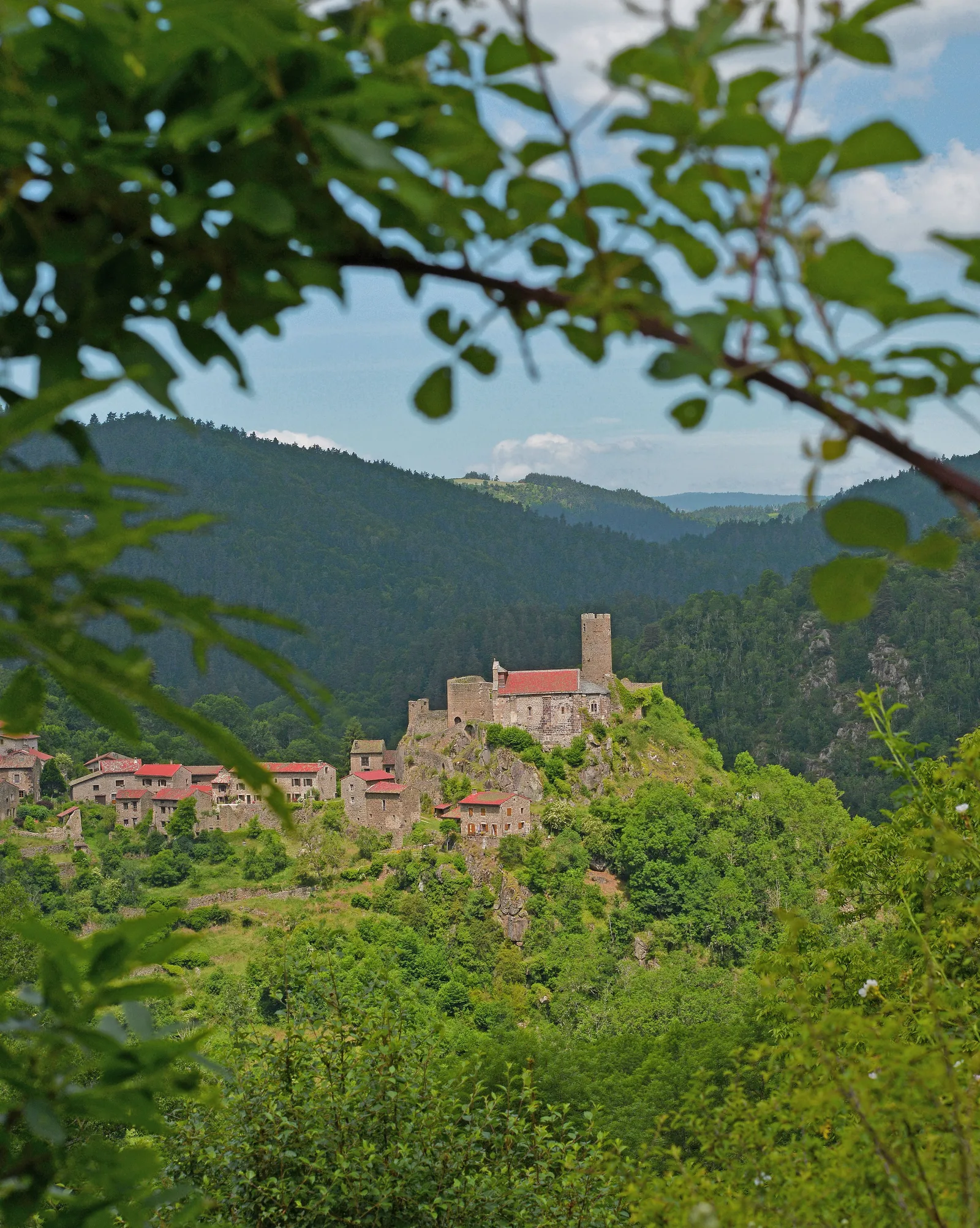
You can discover the Ance valley, the natural border between Languedoc, Forez and Velay, overlooked by one of the most beautiful historic sites in Haute-Loire, the village of Chalencon and its medieval castle.
1. From the town hall of Saint-André-de-Chalencon, go around the church on the right and leave the village by the small road. At the cemetery, turn onto the road at
right. It crosses the hamlet of Les Granges. Go straight ahead and win
Mount.
2. In the hamlet, turn left, then take the path on the left.
Continue along the path which descends and enters the undergrowth. Narrow, it comes to a
fork.
3. Keep left. The trail descends into the woods. Continue along the hillside and come out at a junction shortly before entering Chalencon.
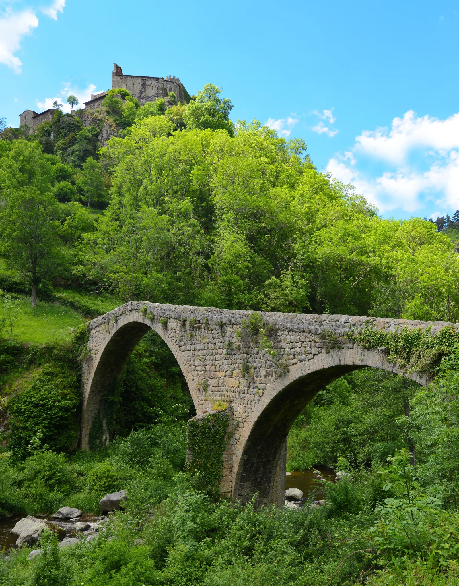
> Access to the Devil's Bridge (800 m round trip, 20 min).
4. Continue for 50 m to the entrance to Chalencon.
> Access to the village (feudal castle locking the Ance valley and controlling exchanges between the three provinces, chapel) on the right.
5. Go up the road on the left until the lace. Continue on the road for 100 m.
6. Cross the car park and go up the path. He reaches a flat area in the undergrowth.
7. Turn off on the left path. At the top, the path comes out of the woods and continues between the fields to Saint-André-de-Chalencon. Turn left to find the town hall.
UTM coordinates: 31 T 0576090 5013756
1. From the town hall of Saint-André-de-Chalencon, go around the church on the right and leave the village by the small road. At the cemetery, turn onto the road at
right. It crosses the hamlet of Les Granges. Go straight ahead and win
Mount.
2. In the hamlet, turn left, then take the path on the left.
Continue along the path which descends and enters the undergrowth. Narrow, it comes to a
fork.
3. Keep left. The trail descends into the woods. Continue along the hillside and come out at a junction shortly before entering Chalencon.
> Access to the Devil's Bridge (800 m round trip, 20 min).
4. Continue for 50 m to the entrance to Chalencon.
> Access to the village (feudal castle locking the Ance valley and controlling exchanges between the three provinces, chapel) on the right.
5. Go up the road on the left until the lace. Continue on the road for 100 m.
6. Cross the car park and go up the path. He reaches a flat area in the undergrowth.
7. Turn off on the left path. At the top, the path comes out of the woods and continues between the fields to Saint-André-de-Chalencon. Turn left to find the town hall.
UTM coordinates: 31 T 0576090 5013756