Entire route 22,6 km – cumulative positive elevation 332m, cumulative negative elevation 64m
DEPARTURE :
– In Lavoûte-sur-Loire, parking lot of the Saint-Maurice church or Imp de la Gare
– In Yssingeaux, Antreuil car park, Bus Station
DEPARTURE :
– In Lavoûte-sur-Loire, parking lot of the Saint-Maurice church or Imp de la Gare
– In Yssingeaux, Antreuil car park, Bus Station
Alert
Attention, passage on the departmental to cross the Swiss at the level of Beaulieu, possibility of automobile crossings and crossing of municipal road between Beaulieu and Rosières.
VIGILANCE: to be had at the level of the quarry in Saint-Julien-du-Pinet, heavy goods vehicles can circulate during the week.
SUMMER 2022: risk of traffic cuts at the Warren bridge in Lavoûte-sur-Loire, please consult our "route news" page at the bottom of the home page.
VIGILANCE: to be had at the level of the quarry in Saint-Julien-du-Pinet, heavy goods vehicles can circulate during the week.
SUMMER 2022: risk of traffic cuts at the Warren bridge in Lavoûte-sur-Loire, please consult our "route news" page at the bottom of the home page.
Description
From Lavoûte-sur-Loire to Saint-Julien-du-Pinet: groomed surface, gravel and irregularity (not recommended for road bikes, rollerblades and scooters) on cycle route.
From Saint-Julien-du-Pinet to Yssingeaux: coated surface accessible to all, alternating cycle route & greenway.
VIGILANCE: to be had at the level of the quarry in Saint-Julien-du-Pinet, heavy goods vehicles can circulate during the week.
SUMMER 2022: risk of traffic cuts at the Warren bridge in Lavoûte-sur-Loire, please consult our "route news" page at the bottom of the home page.
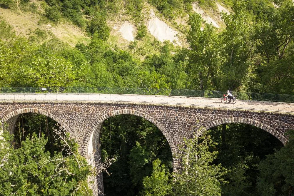
This route is a warm-up on the balconies of the Loire, across the Emblavez plain, one of the few on the route, you will discover an open landscape offering beautiful perspectives on the juices of Velay.
Our favorites…
• Chateau Lavoute-Polignac
• The ravines of Corboeuf
• The Moulin du Pinard
• The Chapel of Glavenas
Take a break !
• Lavoûte sur Loire – 568m above sea level
• Beaulieu – 586m above sea level
• Rosières – 666 m above sea level
• Saint-Julien-du-Pinet – 896 m above sea level
• Yssingeaux – 835 m above sea level
From Saint-Julien-du-Pinet to Yssingeaux: coated surface accessible to all, alternating cycle route & greenway.
VIGILANCE: to be had at the level of the quarry in Saint-Julien-du-Pinet, heavy goods vehicles can circulate during the week.
SUMMER 2022: risk of traffic cuts at the Warren bridge in Lavoûte-sur-Loire, please consult our "route news" page at the bottom of the home page.
This route is a warm-up on the balconies of the Loire, across the Emblavez plain, one of the few on the route, you will discover an open landscape offering beautiful perspectives on the juices of Velay.
Our favorites…
• Chateau Lavoute-Polignac
• The ravines of Corboeuf
• The Moulin du Pinard
• The Chapel of Glavenas
Take a break !
• Lavoûte sur Loire – 568m above sea level
• Beaulieu – 586m above sea level
• Rosières – 666 m above sea level
• Saint-Julien-du-Pinet – 896 m above sea level
• Yssingeaux – 835 m above sea level